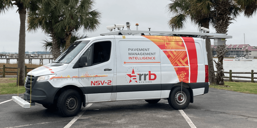
The Hawkeye Network Survey Vehicle was used to collect 3D scans of the pavement and right-of-way imagery on over 1,100 miles of roadway.
Overview
The City of Raleigh, the Capital City of the State of North Carolina, remains one of the fastest growing metropolitan areas in the USA.
1100 Miles
Raleigh’s Transportation Department not only wanted to collect pavement condition information but needed an effective and efficient data management system. The Hawkeye Network Survey Vehicle, along with Hawkeye Insight, was the winning combination.
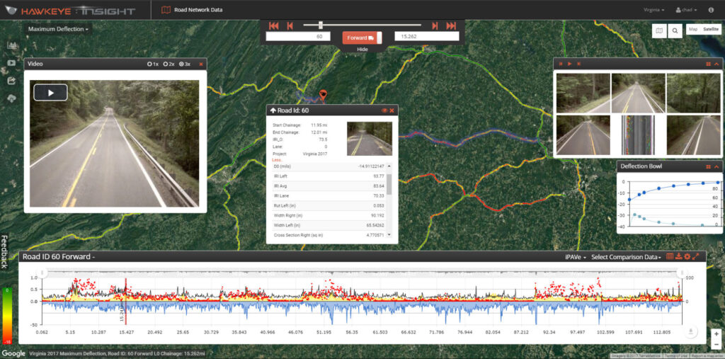
The Hawkeye Network Survey Vehicle was used to collect 3D scans of the pavement and right-of-way imagery on over 1,100 miles of roadway. All data and associated imagery were delivered through the Hawkeye Insight platform. This web-based viewing tool enables intuitive visualization of collected data.
‘Drive through’ the roadway network
The advantage of Hawkeye Insight was its interactive and highly visual interface, allowing city staff to access data quickly and identify points of interest through intuitive filtering. The staff could also virtually ‘drive through’ the roadway network from the office environment, making maintenance decision-making faster and efficient. The linking of Hawkeye Insight to the City’s pavement management system has enabled the seamless integration of the two systems and allows city staff to access information about roads of interest easily.
The comprehensive nature of ARRB Systems’ service is one thing, but it’s the delivery of data in Hawkeye Insight that made it easy for city staff to understand and utilize the data collected during this project. The data have since been incorporated into the City’s Pavement Management System, which the City uses to make better decisions and maintain roads efficiently.