Products

Hawkeye 2000

Hawkeye 2000 Series is the most complete and intelligent data collection system in the world.

Modular, scalable and customisable, it’s fit for the most demanding of road survey requirements.

Add Your Heading Text Here

Add Your Heading Text Here

Hawkeye Series

General Overview

The Hawkeye 2000 Series is an integrated network survey solution, offering complete scalability and customised functionality for consistent, synchronised data collection across multiple vehicles.

background graphic
Background graphic
application-icon
Powerful tool to manage the condition, maintenance and life-cycle of road networks
application-icon
Collects all pavement surface and structural parameters with high accuracy in one pass
application-icon
Ability to operate at traffic speeds, improving production, safety and efficiency
application-icon
Cost efficient, rapid data collection without the need for traffic control
application-icon
Continuous measurements at higher resolution than traditional means (e.g. FWD)
application-icon
Provides comprehensive data to make truly informed decisions on the type of rehabilitation and surfacing treatments required

Digital Laser Profiler

Laser profiler accurately records the roughness and texture (MPD and SMTD) of the road surface.
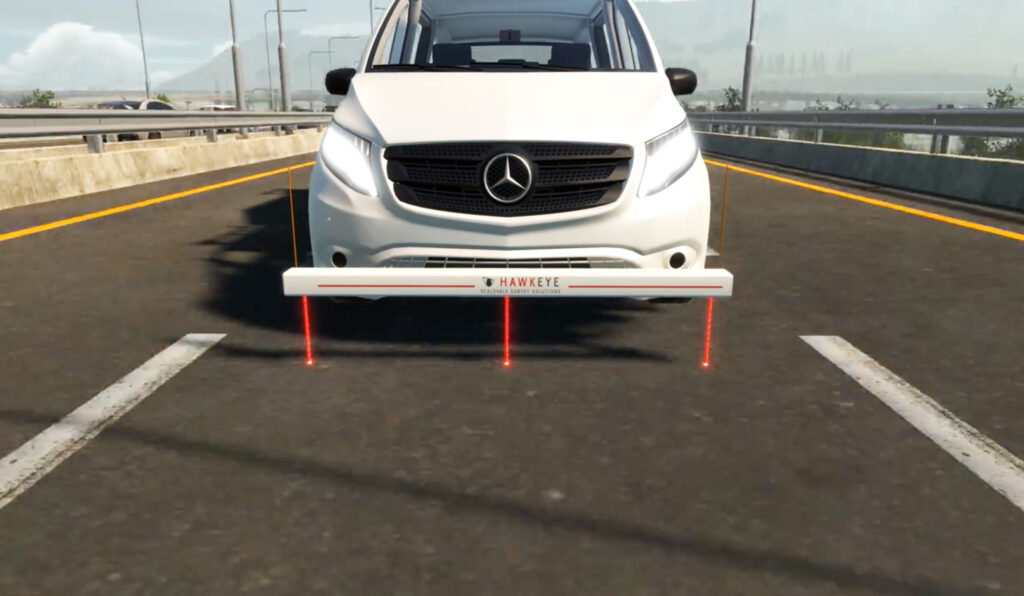
Hawkeye 2000 - Digital Laser Profiler (DLP)

37,282

Miles of data captured, analysed, and used to implement targeted improvements and enhance road quality.

Hawkeye 2000 advanced features

The Hawkeye Automatic Crack Detection (ACD) system is the most advanced cracking system available in the industry.
  • Rut depth measured over 4 m width at 1 mm transverse resolution
  • 28,000 profiles collected per second
  • Day and night operation, unaffected by shadows
  • Low power consumption
  • Data compression algorithms to minimize storage
  • Lightweight and waterproof
  • Measurements are possible on all sealed surfaces
  • Data collection down to 0.5km / hr, with the use of our pedestrian safety module
  • Increased 3D imagery and crack processing times, utilising our distributed processing system
Available outputs
Multiple crack analysis reports PCI China
Rutting Rutting
Potholes / Delamination Straight Edge
Ravelling String Line
Macrotexture Brazilian
Lane Marking Moving Bar
Shoving Potholes / Delamination
Bleeding Ravelling
Cracks Macrotexture
Crack Percentage Lane Marking
DPTI SA Shoving
Cracking Ratio Bleeding
RoadCrack Multiple crack analysis reports
Rutting
The Hawkeye 2000 Digital Laser Profiler (DLP) can be configured to meet the specific needs of your road condition data.
  • Scalable to allow for the addition of more lasers (up to 15 lasers)
  • Rugged, aluminium beam design
  • Operational at highway speeds to reduce survey time and costs
  • Results are independent of vehicle type
  • Measurements possible on all sealed surfaces
  • Data is linked to chainage and GPS coordinates
Available outputs
Roughness Putting
Longitudinal profile Faulting
Transverse profile Macrotexure
The newly released GIPSI-Trac2 is the next generation GNSS + INS (Global Navigation Satellite Systems + Inertial Navigation System) geometry module.
  • Uses an integrated GNSS receiver and dead-reckoning inertial sensors
  • 200Hz fused data output
  • Typical mapping accuracy of 1.2 m
  • Exports to CSV and point or polyline shapefiles
  • Readily interfaces with a number of GIS packages
  • Has fully customisable GPS projection methods (Lat, Long, Easting, Northing and a range of datums)
Available outputs
Grade Inertially corrected GNSS position
Cross slope Horizontal and vertical curvature
Distance
The Hawkeye 2000 Digital Imaging System supports both asset and pavement view cameras, featuring the latest digital photography technology.
  • Provides continuous digital images
  • Supports up to eight Asset View cameras
  • Full colour, high resolution imagery
  • Standard HD, Widescreen HD and 4K options
  • Supports two Pavement View cameras
  • Black and white, linescan imagery
  • Uses .AVI storage files
  • Images can be used to measure, geo-reference and note points of interest
Available outputs
Digital imagery GPS location/distance
Interactive Design

We are iRAP accredited

iRAP accreditation helps ensure that iRAP assessments are performed to the same consistently high level of quality worldwide. Practitioners that are accredited can become part of a market of practitioners/suppliers that are able to bid competitively to provide iRAP-specification services.

Key road assessment applications

ARRB’s cutting-edge solutions can applied in various scenarios to enhance road safety, maintenance, and overall infrastructure efficiency.
application-icon

Network, project level road & asset collection surveys

Gather comprehensive data on road networks and infrastructure assets for effective management and planning.

application-icon

Automatic Crack Detection Surveys

Identify and classify cracks in road surfaces to prioritize maintenance and prevent further deterioration.

application-icon

Routine Pavement Monitoring Surveys

Conduct regular inspections to monitor changes in road conditions and identify potential problems early on.

application-icon

Road Geometry and Mapping Surveys

Collect data on road geometry, including elevation, curvature, and cross-section, for design, planning, and safety analysis.

application-icon

Roadside Inventory and Asset Management Inspections

Inventory roadside assets (signs, guardrails, utility poles) and assess their condition for maintenance or replacement.

Discover how our technology drives real-world success for:

Case study

Thailand Department of Highways

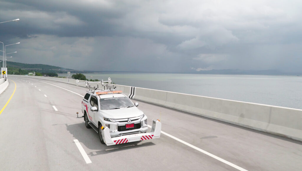
The Department of Highways (DOH), Thailand builds and maintains the country’s highway network, as well promoting social and economic aspects both within the country, and the ASEAN region.
Thai case study