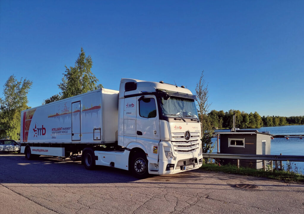
The intelligent Pavement Assessment Vehicle is the first and only comprehensive pavement measurement system in the world, providing structural and surface condition data at highway speeds.
It’s a revolution in pavement management with complete datasets collected efficiently using state-of-the-art technology.
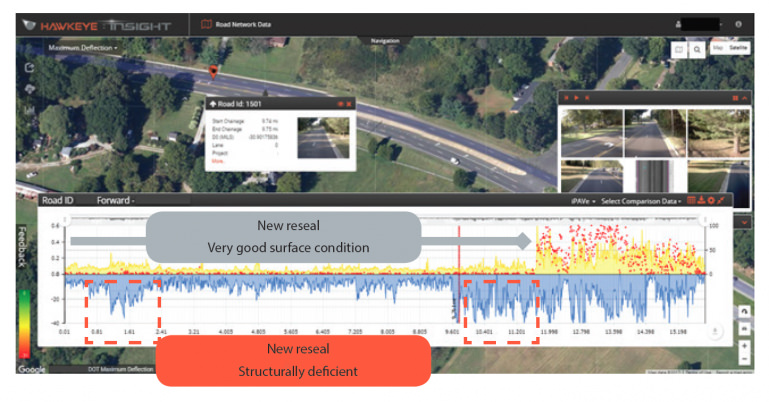
The iPAVe provides continuous pavement deflection profiles, from which bearing capacity indices can be derived and pavement fatigue can be estimated. The high accuracy and resolution of the iPAVe data enable engineers to pinpoint areas where the pavement structure may be subject to failure, providing an additional dimension for pavement evaluation.
The below image shows a newly paved surface on a 26km sample of road. A thin overlay was completed along the first 19kms, due to high levels of roughness, rutting and cracking. However, the iPAVe data shows there are two underlying pavement structural problem areas which will lead to premature failure of the road. Had this pavement been structurally evaluated before the overlay, full rehabilitation could have been performed in these areas to provide a more effective treatment solution.


iPAVe can gather a wide range of data on road conditions, including pavement surface characteristics, structural parameters, and geometric information. This allows for a holistic assessment of road health.
Powerful tool to manage the condition, maintenance and life-cycle of road networks
Collects all pavement surface and structural parameters with high accuracy in one pass
Ability to operate at traffic speeds, improving production, safety and efficiency
Cost efficient, rapid data collection without the need for traffic control
Continuous measurements at higher resolution than traditional means (e.g. FWD)
Provides comprehensive data to make truly informed decisions on the type of rehabilitation and surfacing treatments required
iPAVe provides a comprehensive solution for managing road infrastructure, helping to ensure that roads remain safe, functional, and cost-effective.
iPAVe is equipped with advanced sensors that can gather a wide range of data on road conditions, including pavement surface characteristics, structural parameters, and geometric information. This data is collected with high accuracy, providing a detailed picture of road health.
iPAVe can survey roads at high speeds, reducing the time and cost required for data collection. This also improves safety by minimizing disruptions to traffic flow.
iPAVe’s efficient data collection process reduces the need for traffic control measures, saving time and money.
iPAVe provides continuous measurements at a higher resolution than traditional methods, such as Falling Weight Deflectometer (FWD). This allows for more detailed and accurate assessments of road conditions.
The data collected by iPAVe can be used to make informed decisions about the type and extent of road maintenance and rehabilitation required. This helps to optimize resource allocation and ensure that roads are maintained in a cost-effective and sustainable manner.

