Product specifications
Hawkeye 1000
Portability, flexibility, affordability. If these are your top priorities, then the Hawkeye 1000 Series is the right tool for the job.
Key benefits
- Affordable solutions for profiling and video data
- Operational at highway speeds to reduce survey time and costs
- Customizable modules fitted for purpose specifications
- Highly compactable and transportable with heavy duty hard case
- Complete compatibility with other Hawkeye products
- Supports up to 3 lasers, 3 cameras, Gipsi-Trac2 Geometry and DGPS
- Includes the powerful Hawkeye Processing Toolkit software
Key benefits
- Affordable solutions for profiling and video data
- Operational at highway speeds to reduce survey time and costs
- Customisable modules fitted for purpose specifications
- Highly compactable and transportable with heavy duty hard case
- Complete compatibility with other Hawkeye products
- Supports up to 3 lasers, 3 cameras, Gipsi-Trac2 Geometry and DGPS
- Includes the powerful Hawkeye Processing Toolkit software
Series applications
- Pavement condition, quality and road safety assessments
- Visual identification of roadside features and assets
- Road geometry and complex position for 3D mapping
- Locates areas susceptible to damage (including rainfall ponding)
![](https://arrbsystems.com/wp-content/uploads/2021/04/Hawkeye-1000-image.jpg)
Product features
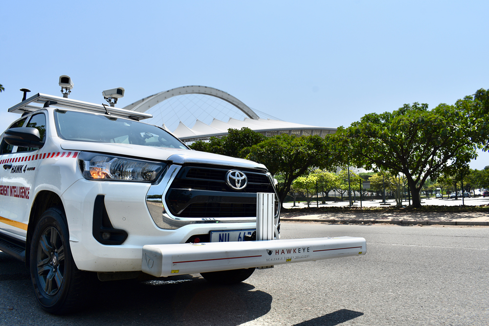
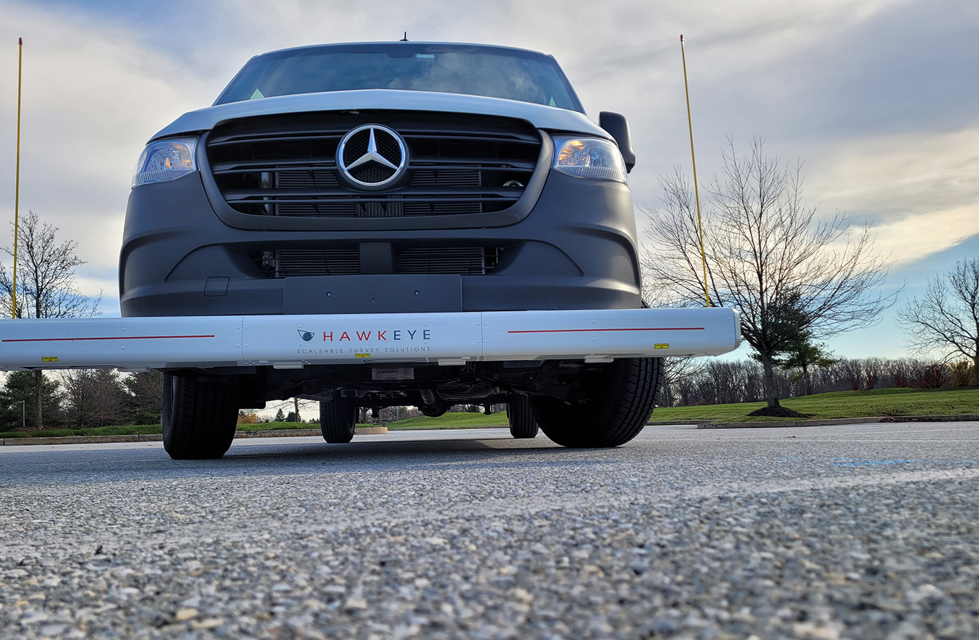
The Hawkeye 1000 Digital Laser Profiler captures detailed road information at high speeds, with easy detachability making it perfect for less frequent survey demands.
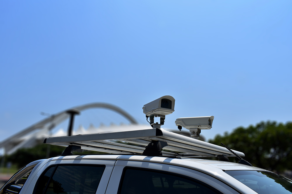
- Uses modern accelerometers and precision laser sensors to compensate for vehicle body movement
- Completely portable, utilising a detachable beam complete with a tow-bar mounting kit
- World Bank Class 1 profiler with a choice of one, two or three laser combinations to suit all budgets
- Can be easily shipped for remote survey requirements and short-term vehicle installations
- Easily installed on a vehicle without special tools or technical personnel
- Lightweight aluminium beam with external weatherproof housing
- Results are independent of vehicle type
Applications
- Pavement condition assessment
- Accurate quality assessments
- Quality control
- Contract validation
Available outputs
- Longitudinal profile
- Roughness (IRI, NAASRA, Ride Number, HATI)
- Macrotexture (MPD and SMTD)
- Rut index
- GPS location/distance
Used to capture roadside features and locate roads, the Hawkeye 1000 Digital Imaging System can be easily transferred between vehicles with its suction mount and transportable carry case.
- Up to three full HD cameras can be supported (roof rack mounted option available)
- Can be shipped for remote survey requirements and short-term vehicle installations
- Uses .AVI storage files
- Ideal for use on a variety of vehicles
- Georeferencing and measurement capabilities
Applications
- Visual identification of roadside features and assets
- Right way of assessment
- Asset location for GIS applications
- Road safety assessment
Available outputs
- Digital imagery
- GPS location/distance
- Shapefiles
The newly released GIPSI-Trac2 is the next generation GNSS + INS (Global Navigation Satellite Systems + Inertial Navigation System) geometry module.
- Uses an integrated GNSS receiver and dead-reckoning inertial sensors
- 200Hz fused data output
- Typical mapping accuracy of 1.2m
- Exports to CSV and point or polyline shapefiles
- Readily interfaces with a number of GIS packages
- Has fully customizable GPS projection methods (Lat, Long, Easting, Northing and a range of datums)
- Uses an integrated GNSS receiver and dead-reckoning inertial sensors
- 200Hz fused data output
- Typical mapping accuracy of 1.2m
- Exports to CSV and point or polyline shapefiles
- Readily interfaces with a number of GIS packages
- Has fully customisable GPS projection methods (Lat, Long, Easting, Northing and a range of datums)
Applications
- Road geometry and complex position for 3D mapping
- Operates in all locations: inside tunnels, under bridges, in highly vegetated or mountainous regions
- Estimate speed and travel times
- Locate potential sites for rainfall ponding
- Conformance to design specifications
Available outputs
- Grade
- Cross slope
- Horizontal and vertical curvature
- Inertially corrected GNSS position
- Distance