Product specifications
Hawkeye 2000
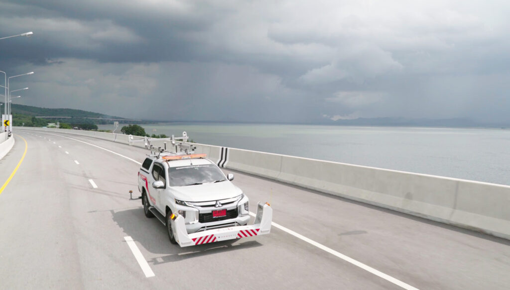
The result of 50 years’ research and development investment, Hawkeye 2000 Series is the most complete and intelligent data collection system in the world – and continues to be refined as new technology emerges.
Key benefits
- Safe & effective, multi-network data collection.
- Low hard-ware, high vehicle versatility.
- Modular design for maximum customizability.
- Flexible & scalable to meet future demands.
- Fully integrated data collection.
- Common data and survey control referencing.
- Single-pass image & condition data collection.
- Easy integration of new technologies.
Key benefits
- Safe & effective, multi-network data collection.
- Low hard-ware, high vehicle versatility.
- Modular design for maximum customisability.
- Flexible & scalable to meet future demands.
- Fully integrated data collection.
- Common data and survey control referencing.
- Single-pass image & condition data collection.
- Easy integration of new technologies.
Series applications
- Network and project level road and asset collection surveys
- Automatic Crack Detection surveys
- Routine pavement monitoring surveys
- Roadside inventory and asset management inspections
- Road geometry and mapping surveys
- Contractor quality control
- Airport runway inspections
Product features
The Hawkeye Automatic Crack Detection (ACD) system is the most advanced cracking system available in the industry.
- Rut depth measured over 13 ft width at 0.04 in. transverse resolution
- 28,000 profiles collected per second
- Day and night operation, unaffected by shadows
- Low power consumption
- Data compression algorithms to minimize storage
- Lightweight and waterproof
- Measurements are possible on all sealed surfaces
- Data collection down to 0.3 mph, with the use of our pedestrian safety module
- Increased 3D imagery and crack processing times, utilizing our distributed processing system
- Rut depth measured over 4 m width at 1 mm transverse resolution
- 28,000 profiles collected per second
- Day and night operation, unaffected by shadows
- Low power consumption
- Data compression algorithms to minimize storage
- Lightweight and waterproof
- Measurements are possible on all sealed surfaces
- Data collection down to 0.5km / hr, with the use of our pedestrian safety module
- Increased 3D imagery and crack processing times, utilising our distributed processing system
Available outputs
- Multiple crack analysis reports
- Rutting
- Potholes / Delamination
- Ravelling
- Macrotexture
- Lane Marking
- Shoving
- Bleeding
- Cracks
- Crack Percentage
- DPTI SA
- Cracking Ratio
- RoadCrack
- PCI China
- Rutting
- Straight Edge
- String Line
- Brazilian
- Moving Bar
- Potholes / Delamination
- Ravelling
- Macrotexture
- Lane Marking
- Shoving
- Bleeding
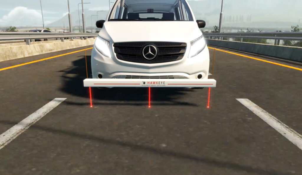
The Hawkeye 2000 Digital Laser Profiler (DLP) can be configured to meet the specific needs of your road condition data.
- Scalable to allow for the addition of more lasers (up to 15 lasers)
- Rugged, aluminium beam design
- Operational at highway speeds to reduce survey time and costs
- Results are independent of vehicle type
- Measurements possible on all sealed surfaces
- Data is linked to chainage and GPS coordinates
Available outputs
- Roughness
- Longitudinal profile
- Transverse profile
- Rutting
- Faulting
- Macrotexture
The newly released GIPSI-Trac2 is the next generation GNSS + INS (Global Navigation Satellite Systems + Inertial Navigation System) geometry module.
- Uses an integrated GNSS receiver and dead-reckoning inertial sensors
- 200Hz fused data output
- Typical mapping accuracy of 3.9 ft
- Exports to CSV and point or polyline shapefiles
- Readily interfaces with a number of GIS packages
- Has fully customizable GPS projection methods (Lat, Long, Easting, Northing and a range of datums)
- Uses an integrated GNSS receiver and dead-reckoning inertial sensors
- 200Hz fused data output
- Typical mapping accuracy of 1.2 m
- Exports to CSV and point or polyline shapefiles
- Readily interfaces with a number of GIS packages
- Has fully customisable GPS projection methods (Lat, Long, Easting, Northing and a range of datums)
Applications
- Road geometry and complex position for 3D mapping
- Operates in all locations: Inside tunnels, Under bridges, Highly
- vegetated or mountainous regions
- Estimate speed and travel times
- Locate potential sites for rainfall ponding
- Conformance to design specifications
Available outputs
- Grade
- Cross slope
- Horizontal and vertical curvature
- Inertially corrected GNSS position
- Distance
The Hawkeye 2000 Digital Imaging System supports both asset and pavement view cameras, featuring the latest digital photography technology.
- Provides continuous digital images
- Supports up to eight Asset View cameras
- Full colour, high resolution imagery
- Standard HD, Widescreen HD and 4K options
- Supports two Pavement View cameras
- Black and white, linescan imagery
- Uses .AVI storage files
- Images can be used to measure, geo-reference and note points of interest
Applications
- Asset View DIS
– Visual identification of roadside features and assets
– Right-of-way roadside condition assessment
– Asset location for GIS applications
– Road safety engineering assessment - Pavement View DIS
– Pavement condition and deterioration assessment
– Road surface marking identification
– Crack screening and measurement
– Verification and validation of other data streams
Available outputs
- Digital imagery
- GPS location/distance
- Interactive Design