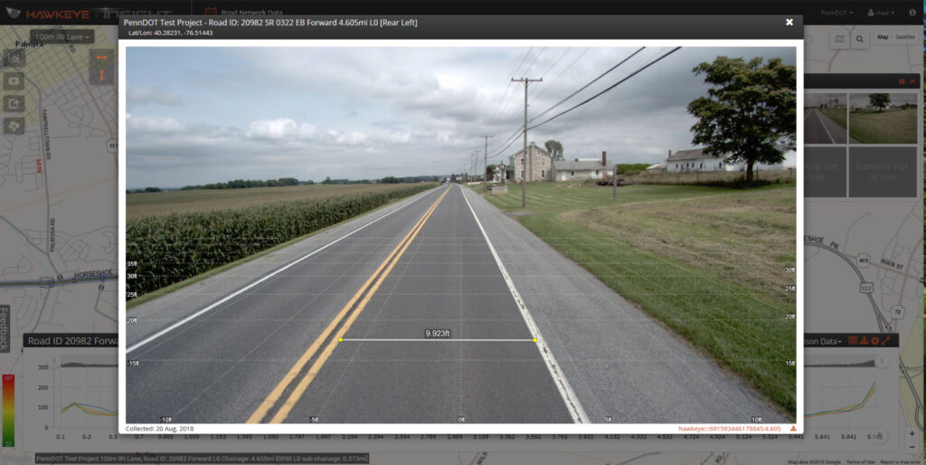
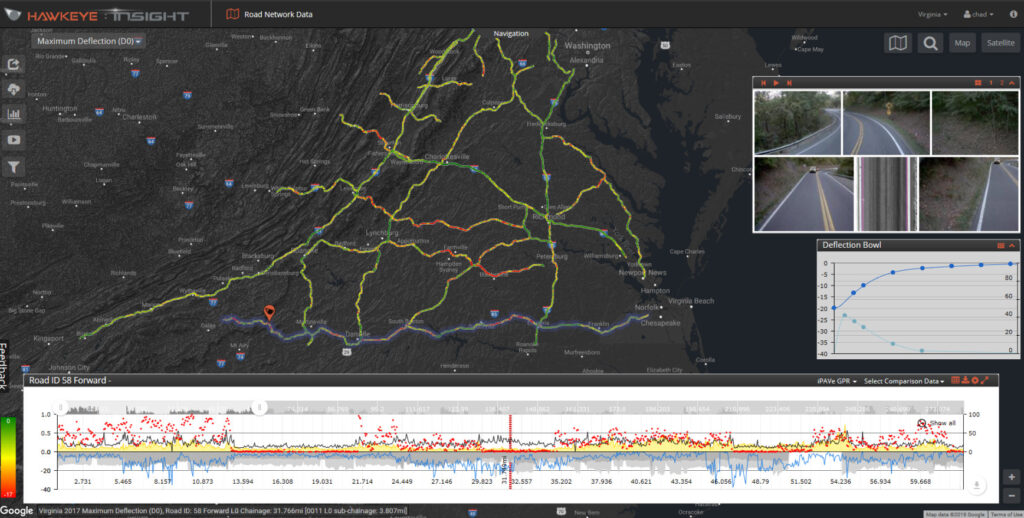
Hawkeye Insight offers multiple concurrent video channels, enabling users to virtually ‘drive’ their roads. Each calibrated camera provides advanced zoom, measurement, and inspection capabilities, including automatic crack detection data. Easily enter road numbers, distance information, or pan to your desired location for instant analysis.


Over 476,852.01 kms / 296,302.10 miles of survey data from across four continents has been published, including deflection bowls and slopes, cracking, rutting, roughness, geometry, pavement distresses and friction. This data is then accessed by road owners, to assist in management of their road networks.
When surveying with the iPAVe, heatmap filters allow users to easily determine the quality of the road surface and underlying pavement layers.
View exact locations via road name, number, or latitude/longitude, ensuring accurate and detailed geographic data for all users.
Display individual images alongside output charts, integrating Google Maps for easy and intuitive visual analysis of data.
Access data from anywhere on various platforms, overcoming common IT issues and eliminating the need for software installation.
Utilize advanced filters for heatmaps and custom parameters, enabling detailed and specific data retrieval, including deflection and surface condition.
Benefit from a fully integrated data collection system with a modular design, allowing easy adoption of new technology and expansion as needs change.
Collect all condition data and imagery in a single pass with the Heartbeat Module, ensuring safe and efficient surveys for both urban and highway environments.
ARRB’s cutting-edge solutions can applied in various scenarios to enhance road safety, maintenance, and overall infrastructure efficiency.


Director
Enter your details below to get the latest in road tech and global insights delivered straight to your inbox.