Over 476,852.01 kms / 296,302.10 miles of survey data from across four continents has been published, including deflection bowls and slopes, cracking, rutting, roughness, geometry, pavement distresses and continuous friction data. This data is then accessed by road owners, to assist in management of their road networks.
热图高级过滤器
When surveying with the iPAVe, heatmap filters allow users to easily determine the quality of the road surface and underlying pavement layers.
精确的位置识别
通过路名、编号或经纬度查看确切位置,确保为所有用户提供准确、详细的地理数据。
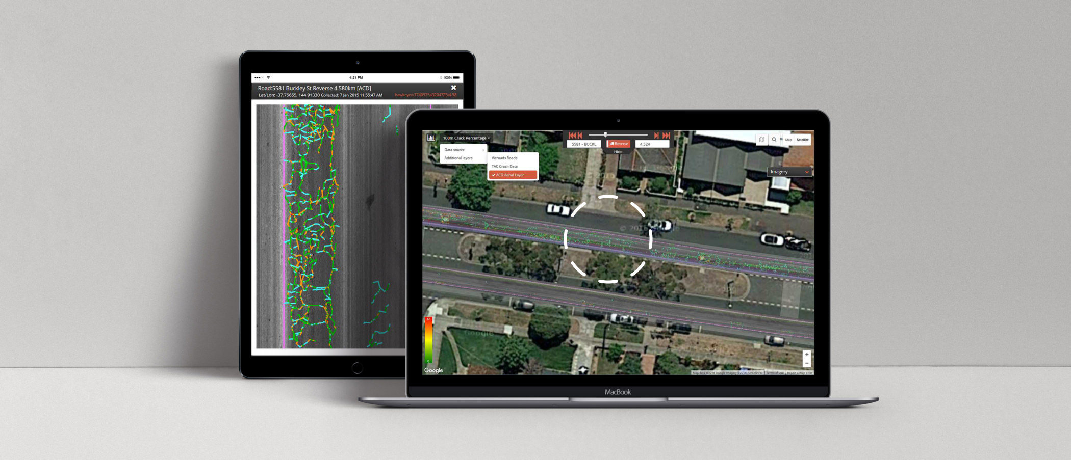
全面的数据可视化
在输出图表旁显示单个图像,集成谷歌地图,轻松直观地进行数据可视化分析。
基于云的可访问性
在各种平台上随时随地访问数据,克服常见的 IT 问题,无需安装软件。
先进的可定制过滤器
Utilize advanced filters for heatmaps and custom parameters, enabling detailed and specific data retrieval, including sub-surface structural deflection and wet pavement surface condition.
集成模块化设计
完全集成的数据收集系统采用模块化设计,便于采用新技术,并可根据需求变化进行扩展。
高效、安全的数据收集
Collect all condition data and imagery in a single pass with the Heartbeat Module, seamlessly integrating data streams from the iSAVe and iPAVe survey vehicles to ensure safe and efficient surveys for both urban and highway environments.”
Hawkeye Insight 高级功能
数据可视化和分析
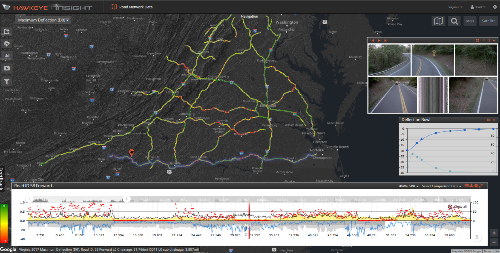
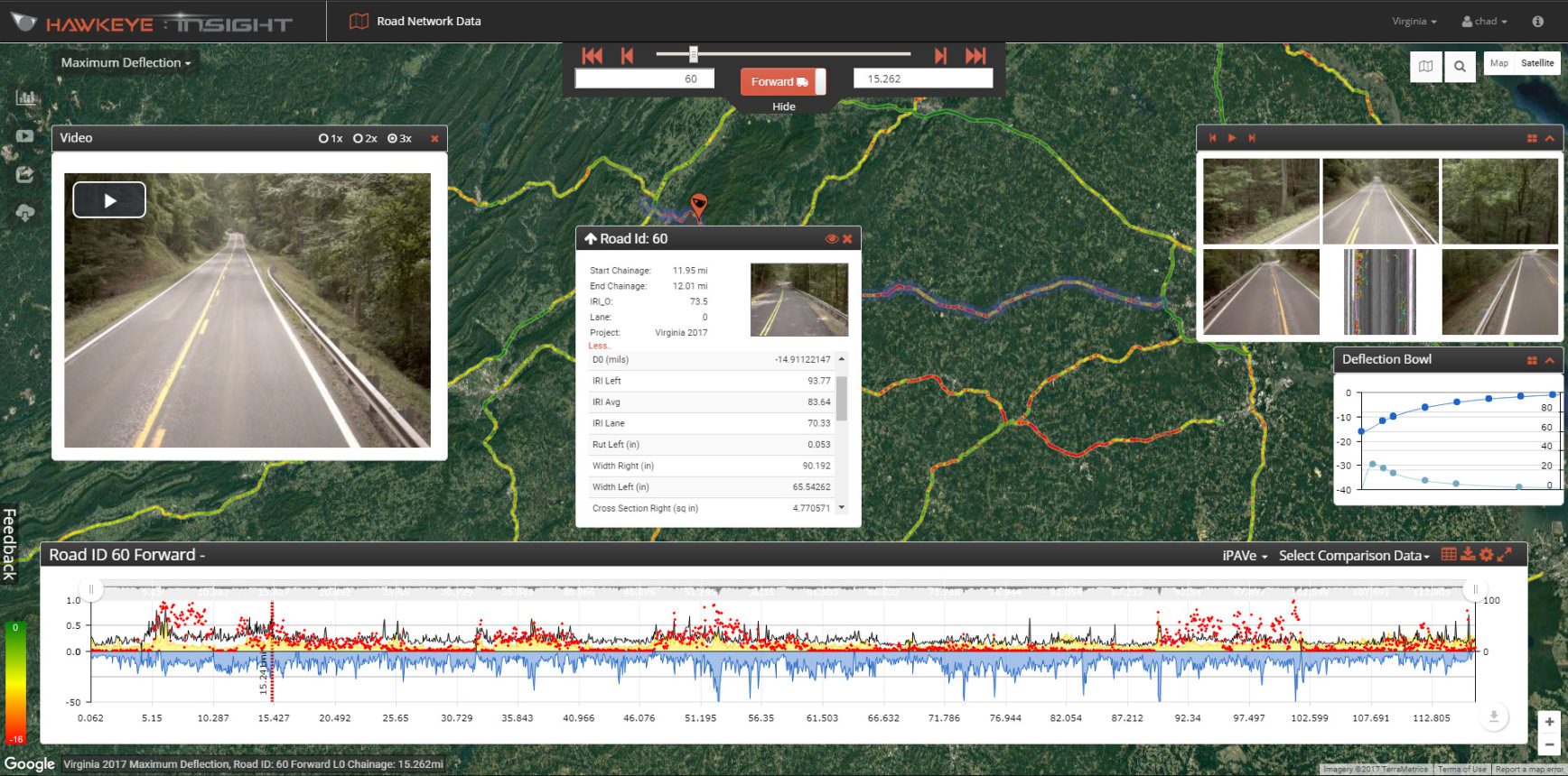
可定制的数据层:显示多个数据层,进行综合分析。
高级过滤:根据各种属性过滤地图数据,以确定感兴趣的特定区域。
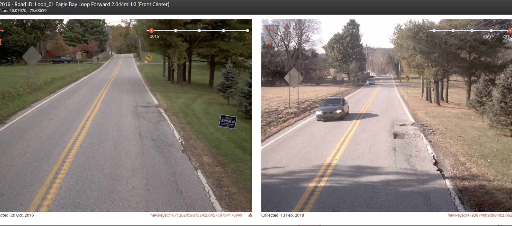
多年比较:利用逐年数据可视化比较不同时期的路况。
裂缝检测分析:通过图表、数值和卫星视图分析裂缝检测数据。
互动制图
直观导航:使用熟悉的谷歌地图功能,轻松浏览道路网络。
视频分析:利用集成的视频功能查看视频片段、测量资产并识别缺陷。
热图分析:使用热图评估路面质量和下层路面。
数据管理与共享
数据共享:通过电子邮件共享视频图像、图表、鹰眼 URL 和桌面视图。
数据导出:导出数据,以便进一步分析或与其他系统集成。
高级功能
多通道视频:可同时查看多达 9 个视频通道,进行全面分析。
高速视频:以高达 30 fps 的速度传输高质量视频。
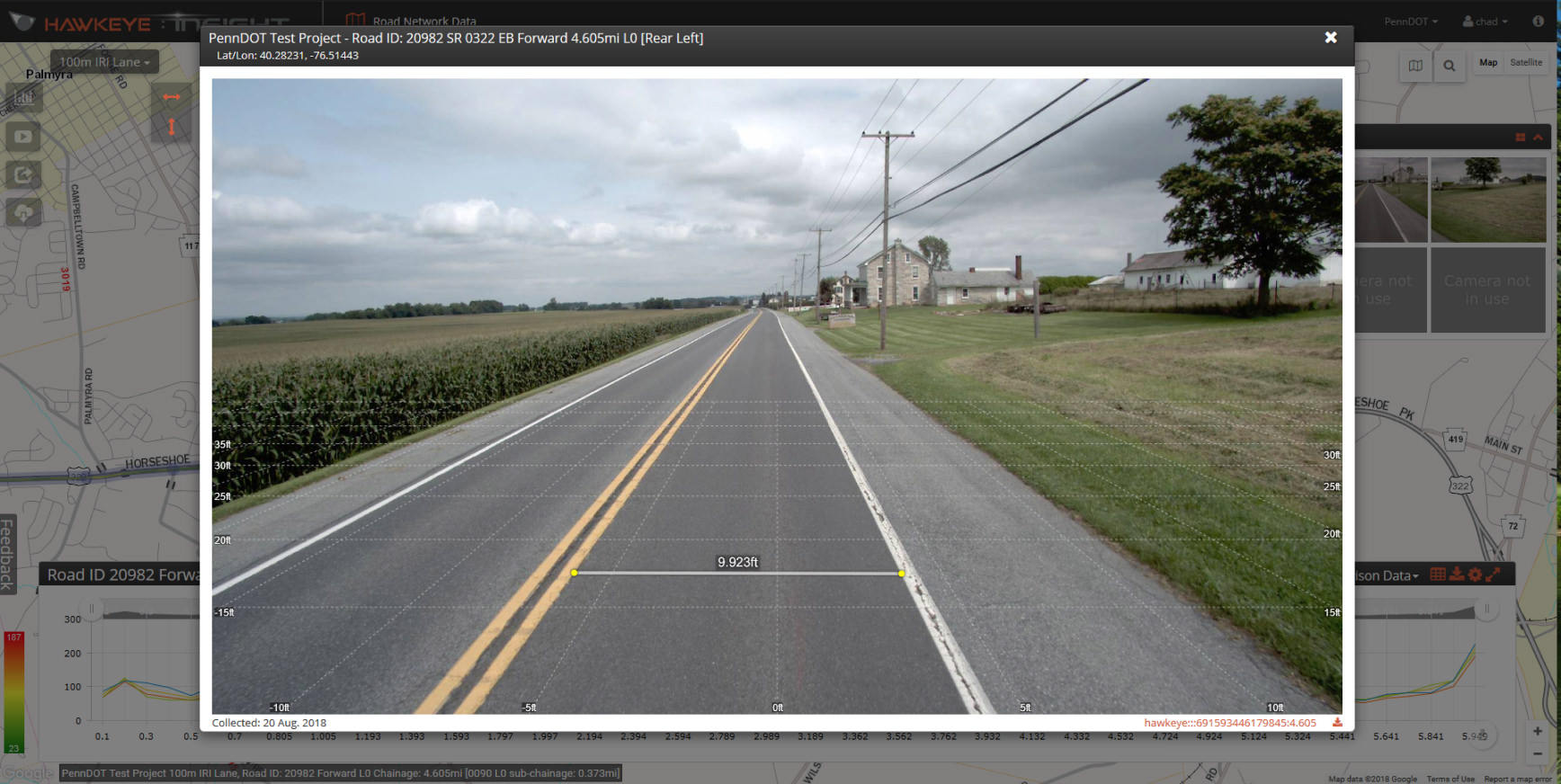
精确测量:使用缩放功能精确测量道路和资产特征。
网络导航:使用道路编号、距离信息或拖放功能,有效导航道路网络。
Hawkeye Insight 功能
Hawkeye Insight 导航功能
主要道路评估应用
ARRB Systems’ cutting-edge solutions can be applied in various scenarios to enhance road safety, maintenance, and overall infrastructure efficiency: